A day of contrasts today.
Woke up to a beautiful sunny day in downtown Winnipeg.
Whilst packing bike in their multi story car park people were arriving with
clip boards and briefcases for meetings and training sessions – made me so glad
not to be at work!
Got out of Winnipeg through the pre rush hour traffic riding
through the leafy suburbs – the houses very similar to those in LA – not seeming
to fit streets with so much traffic.
Crossed over the Red River – want to say “the mighty …”
because it is but won’t. It has so seen much of the history of the development
of Canada – rode alongside it last night to see the home of Louis Riel the controversial Metis Leader found guilty of
high treason by the Canadian Government and hanged in Regina in 1885 - and then
the equally impressive Red River Floodway, built to help alleviate the
devastating floods Winnipeg has experienced as recently as 2011.
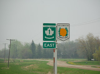
Then on to the Trans-Canada Highway again and for the first
time this trip was actually riding into the sun! Hadn’t gone far when I came
across these signs…
Now I’d ridden 1817 miles since leaving Seattle and that is
well east of the western limits of Canada so to now be just in the middle shows
what a vast country Canada is.
Slowly, imperceptibly the landscape changed. Recalling it
now it is difficult to say what came first, trees I think, more than just the
wind breaks but clumps then quite large plantations and then what appeared to
be forestation. Initially either birch or maybe aspen, definitely no conifers.
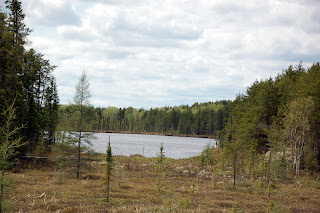
Then water, not lakes but that brackish layer glistening amongst the trees,
then grass. The trees got thicker and fir trees made an appearance. There were
turtles in the water at each side of the road, I know because sadly I saw those
that hadn’t made it across.
I began climbing slightly and outcrops of granite began to
appear along the roadside and then it was clear the road had been blasted
through larger granite rocks. I was having to lean the bike more – bends –
where did they come from, not corners but sweeping long lazy curves.
and just to give some scale that is not THE Trans-Canada Highway, that is just the east bound carriageway, the west bound is away through the trees somewhere.
The trees
crept in closer to the road and as I was still often on my own it’s difficult
to say which is more disconcerting – being alone in a vast emptiness or in the
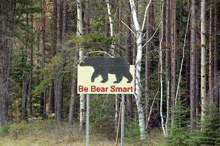
now quite thick fir forests. No problem though was there I mean not much big
wild life around here…
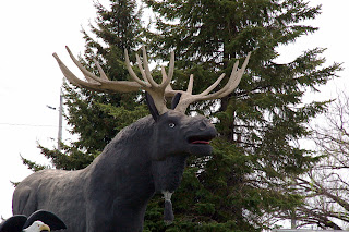
Wrong! |
| Roger, explain in less than 400 words! |
Crossed over into Ontario
and then the lakes started, not big ones just lots of small areas of water by Canada standards, all shimmered in the by now really warm and bright sunshine.
You may have noticed I’ve been very good recently in not going on about the other old routes that I’ve travelled when the run into the Trans-Canada Highway as well as the old route of the Highway itself...
There have been a few but latterly the Yellow Head Trail has been alongside me.
It is apparently a successor of the Old Northwest Trail
which extended from Winnipeg to Edmonton, spanning a distance of 1900 miles. It follows some of the original trails that
were part of the fur trade and the buffalo hunts that reached as far as
Edmonton in the west.
Another is the Old Dawson Trail,
the first all-Canadian
route that linked the Great Lakes with the Canadian prairies. It was a water
and land route that began at Fort William (now Thunder Bay, Ontario) and ended
at St. Boniface (now Winnipeg, Manitoba).
Whilst doing a slight detour down the Old Dawson Trail -I know what I said yesterday but that referred to planned detours - I saw this church at a little place called Richer which must be worth a photograph..
On researching after I find the Roman Catholic Church was built in 1913 by the local French
Canadian and Métis community. The grotto to the right was built in 1954 and is dedicated to Notre Dame de Lourdes
who appeared to a peasant girl, Bernadette Soubirou.
Sorry, but these trails fascinate me!
Back to today, I stopped off at Kenora, the first of the beautiful lakeside
towns of the Canadian “Sunset Country” stretching from the Manitoba boundary to
the edge of Lake Superior.
It had a very Mediterranean feel, mainly I guess
because I had lunch – unusual for me – at an Italian restaurant outside on the patio
overlooking the float-plane dock – hey, man can’t survive on burgers alone –
even if I do give it a good try.
 |
| See, 2 trains - a museum! |
Carried on through equally staggering terrain and the roads
got steeper – though not West coast steep – the lakes bigger, often with rocky, sometime tree covered, islands in them, and the rocks more
prominent.
AS I left Dryden the evening was drawing in so I rode very slowly on to my overnight stop at Ignace peering into every creek, glade and swamp for critters – didn’t see any though I’m afraid.
The motel I’d chosen was, well,
a “surprise”! Run by a friendly enough family of Greek origin it had lots
of interesting sculptures, though hardly of a classical Greek nature. Will be
glad when morning comes.
As I sit typing this we have just had a thunderstorm so been
out to put bike under cover. Got talking to a guy next door who really looks
the Hells Angel part but who, as is often the case, appeared a really nice guy
and ardent bike fan, He says that from now until Sudbury - some 800 miles and 2 days away - I should take it slow
and watch for deer and moose and that I am bound to see them and – if lucky –
bears. Can’t wait.


