Thursday, 30 May 2013

Thursday 30th May - Down to Lake Superior


Up and out this morning before sun up – not that there was any sun to get up all day – well until about 5pm when a very weak one broke through.
Reason for early start was 2 fold, i) I wanted to try and see some wild life and ii) the room at the motel was not one to hang around in.
It rained on and off most of the day and the cloud base was so low that I drifted in and out of fog and mist.  I was happy enough though – disappointed that I wouldn’t get the best of views perhaps but at least the rain was washing the flies of my teeth. By dinner time though I thought I would be trying to make some positives about the “misty views” etc.
But hey, the day turned out to be filled with all kinds of surprises.
This is the town – all of it – that I’d stayed in last night – they all read well in the blurb but somehow miss the spot.


I was heading first of all for a place called Thunder Bay and setting off early, as I did, I promised myself a Canadian breakfast there of eggs – over hard – see getting all the jargon – ham and home-fries.  I got that and it was good.
After riding for a little while the dual carriageway changed to an ordinary 2 way road and remained like that, except for a few passing places for the rest of the journey. In some places you could see where the original road had gone before any upgrades and those are always interesting routes to take – even if most meant doubling back eventually.
 
 But I was in  no hurry and keen to spot some kind of critter.  I accept it was early but I was still mostly on my own and this is a main cross country link!
 
I was fascinated by the lichen. Yes, we’ve all seen it but this stuff was so thick and scaly, no it wasn’t moss – I’d ask Roger again but if I carry on he’ll want paying as an advisor.
 

I got excited by the signs – I know sad – and slowed down even more to peer into the undergrowth, which was silly really as moose are the size of, well moose.
 

I was intrigued by this church but it was at the other side of a railway track with no obvious crossing. Wasn’t too far from these abandoned stores so wonder if there was an old town here once - now long gone. Real cowboy town buildings aren’t they.


Then – a time zone change! Why can’t they all be like this and then everyone will be clear. There was this plaque there too about Sir  Sandford Fleming – no I hadn’t heard of him either – but he was born on Scotland and responsible for “inventing” the Standard Time Zones – probably fed up of making a prat of himself in hotels!

 
Met a policeman at this stop whose father came from Bradford but he, the policeman, had never been to England to visit, probably for the best!
The road was going on and on and up and down and my eyes were going from side to side like an ”Eagle Eyes” Action Man. 
 
 It paid off though because I saw this chap in time to stop. No idea what he is – looks like a black fox but they don’t seem to exist. He was obviously rare though and had few friends as he came closer and closer and if I’d opened my pannier I think he would have jumped in.


Thunder Bay was another disappointment – perhaps the gloom again taking the shine off any attraction it had.
Just before Thunder Bay the 2 divided North and South routes re-joined and ran along the northern shore of Lake Superior. I was excitedly anticipating my first view of this vast lake but when it came it was snatched through trees and partially hidden by the cloud. What I could see though was beautiful – not any great impression of size because at that pint there was “The Sleeping Giant” peninsular running across the view and then various small islands just off-shore.


I liked this sign, twee as it may be...
 
As a rode along the trees suddenly changed colure to a really spring-like light green, the photo probably doesn’t show it but the colour change was spectacular.

 
 I carried on enjoying the ride but wary when the cloud got a bit thick especially as the road got narrower and began to hug the cliff side more.

Even the coffee stops were lonely affairs...
                  except the lady owner here told me a lovely story about a book called Paddle to the Sea which I'll explain tomorrow.


On I went with Assistant Lookout Frog on duty – he lost his Navigator status when he got us lost on the way to Steinbach.
Got stripes back though when he spotted this chap (or chappess – how do you sex a moose?) 
 
Watched it for quite a while and was fascinated when it knelt down to eat – which answers that earlier question about knees.


The excitement builds up too about Winnie-the-Pooh and Lyndsay makes a good point – where did his second name come from?
 
Maybe we’ll find out tomorrow – hang on in there with me.


Wednesday, 29 May 2013

Wednesday 29th May - Leaving the Praries and on to Ontario


A day of contrasts today.

Woke up to a beautiful sunny day in downtown Winnipeg. Whilst packing bike in their multi story car park people were arriving with clip boards and briefcases for meetings and training sessions – made me so glad not to be at work!
Got out of Winnipeg through the pre rush hour traffic riding through the leafy suburbs – the houses very similar to those in LA – not seeming to fit streets with so much traffic.

Crossed over the Red River – want to say “the mighty …” because it is but won’t. It has so seen much of the history of the development of Canada – rode alongside it last night to see the home of Louis Riel  the controversial Metis Leader found guilty of high treason by the Canadian Government and hanged in Regina in 1885 - and then the equally impressive Red River Floodway, built to help alleviate the devastating floods Winnipeg has experienced as recently as 2011.
Then on to the Trans-Canada Highway again and for the first time this trip was actually riding into the sun! Hadn’t gone far when I came across these signs…
 

Now I’d ridden 1817 miles since leaving Seattle and that is well east of the western limits of Canada so to now be just in the middle shows what a vast country Canada is.
Slowly, imperceptibly the landscape changed. Recalling it now it is difficult to say what came first, trees I think, more than just the wind breaks but clumps then quite large plantations and then what appeared to be forestation. Initially either birch or maybe aspen, definitely no conifers.

 
Then water, not lakes but that brackish layer glistening amongst the trees, then grass. The trees got thicker and fir trees made an appearance. There were turtles in the water at each side of the road, I know because sadly I saw those that hadn’t made it across.
I began climbing slightly and outcrops of granite began to appear along the roadside and then it was clear the road had been blasted through larger granite rocks. I was having to lean the bike more – bends – where did they come from, not corners but sweeping long lazy curves.


and just to give some scale that is not THE Trans-Canada Highway, that is just the east bound carriageway, the west bound is away through the trees somewhere.
 
The trees crept in closer to the road and as I was still often on my own it’s difficult to say which is more disconcerting – being alone in a vast emptiness or in the now quite thick fir forests. No problem though was there I mean not much big wild life around here…
Wrong!

Some of the trees though appeared to be dying

  Roger, explain in less than 400 words!
                        

Crossed over into Ontario


and then the lakes started, not big ones just lots of small areas of water by Canada standards, all shimmered in the by now really warm and bright sunshine.


I had left the prairies and not really realised it – wow!

You may have noticed I’ve been very good recently in not going on about the other old routes that I’ve travelled when the run into the Trans-Canada Highway as well as the old route of the Highway itself...


There have been a few but latterly the Yellow Head Trail has been alongside me.


It is apparently a successor of the Old Northwest Trail which extended from Winnipeg to Edmonton, spanning a distance of 1900 miles.  It follows some of the original trails that were part of the fur trade and the buffalo hunts that reached as far as Edmonton in the west.
Another is the Old Dawson Trail,
 
the first all-Canadian route that linked the Great Lakes with the Canadian prairies. It was a water and land route that began at Fort William (now Thunder Bay, Ontario) and ended at St. Boniface (now Winnipeg, Manitoba).
Whilst doing a slight detour down the Old Dawson Trail -I know what I said yesterday but that referred to planned detours - I saw this church at a little place called Richer which must be worth a photograph..
 
On researching after I find the Roman Catholic Church was built in 1913 by the local French Canadian and Métis community. The  grotto to the right was built in 1954 and  is dedicated to Notre Dame de Lourdes who appeared to a peasant girl, Bernadette Soubirou.
Sorry, but these trails fascinate me!
Back to today, I stopped off at Kenora, the first of the beautiful lakeside towns of the Canadian “Sunset Country” stretching from the Manitoba boundary to the edge of Lake Superior.


It had a very Mediterranean feel, mainly I guess because I had lunch – unusual for me – at an Italian restaurant outside on the patio overlooking the float-plane dock – hey, man can’t survive on burgers alone – even if I do give it a good try.
 
See, 2 trains - a museum!

Carried on through equally staggering terrain and the roads got steeper – though not West coast steep – the lakes bigger, often with rocky, sometime tree covered, islands in them, and the rocks more prominent.

 
 Going through the forest at one point this guy passed me - coals to Newcastle eh...
 
The trans-Canada Highway splits then, having a northern and southern route which join up again later. I took the northern route...
 
Stopped again at Dryden, another lakeside town but which was a disappointment. Even their moose – Maximillian – was a bit tame – not only was he smaller and lighter than Mac – being 28ft tall and 9 ton he appeared to have a slightly deranged look and perhaps this time should not be shown to my younger readers!


AS I left Dryden the evening was drawing in so I rode very slowly on to my overnight stop at Ignace peering into every creek, glade and swamp for critters – didn’t see any though I’m afraid.

 
The motel I’d chosen was, well, a “surprise”! Run by a friendly enough family of Greek origin it had lots of interesting sculptures, though hardly of a classical Greek nature. Will be glad when morning comes.


As I sit typing this we have just had a thunderstorm so been out to put bike under cover. Got talking to a guy next door who really looks the Hells Angel part but who, as is often the case, appeared a really nice guy and ardent bike fan, He says that from now until Sudbury  - some 800 miles and 2 days away - I should take it slow and watch for deer and moose and that I am bound to see them and – if lucky – bears. Can’t wait.


Tuesday, 28 May 2013

Tuesday 28th May - Winnipeg


Bit of a bitty day today. Rain was pelting it down still at 5.30 so I cancelled alarm and decided to treat myself to a lay in. Didn’t of course, to “on the roady”.
But got my laundry done – it was open now and had to have some communication with  the guy’s doing the arrangements for freighting my bike back – yes, unfortunately got to start thinking about that.
Lyndsay helped though – found me a BMW dealer in Toronto who is prepared to sell me one of their freight boxes to replace the one that nice customs lady had destroyed. What a star!
By the time all that had been done I set off, in clean thingies, for Winnipeg. By the way did you know Winnie the Pooh is named from Winnipeg. AA Milne got the name from a black bear cub named Winnipeg that had been donated to the zoo when his owner, a Canadian Soldier went off to war.  The soldier -  and bear - originally came from a town White River, in Ontarion, which I may go through later in the trip - exciting stuff eh!
Wanted to see several things today which will probably bore the pants off you I guess, clean or otherwise but involved the settling of the land around here – the Red River area.
The first thing that came to me as I set off was again in the clearing rain was just how vast this country is and how “empty” this part of it was. I was travelling miles in a straight line, 422 yesterday and am still in the prairies with really nothing but a few man-made structures – yes, mainly those elevators, to break up a view which is not barren – although at this time of year crop-less – but certainly doesn’t look very welcoming in this gloom.
 
Then, slowly it began to change. More trees appeared, obviously all planted as windbreaks and not natural forestation but more and more “homesteads” surrounded by such planting began to appear, this one fairly typical...

 
Don’t get me wrong, there were still not that many and they were not all that close together but they were there. The land became darker, richer and as I was thinking how much like home it was, well the flatter parts of Lincolnshire, a sign told me I was in Norfolk – so close eh!
It was in this area that the surveying was started in the Governments attempts at getting people to settle the land west of here. I’d read about the campaigns to encourage emigration which were run in North America and Europe and the practices which went on both by Government Officials and the Railways – who needed customers – which were “questionable” to say the least – sometimes downright deceitful. They banned references to the bad weather etc. and even had their official artists and photographers ensure that all pictures showed a lot of foreground to move the horizon up.

 
Those who moved up from America could, and did, return when they found the land so bare but those unfortunates from Europe, many fleeing from persecution were unable to return “home” so had to make it work or starve.  One group of settlers who had arrived from Eastern Europe – Mennonites – had settled south of Winnipeg in and around Steinbach and I was headed for there to just “have a look”.

But I got lost – how I don’t know but I did. Yes, the roads are all on a grid system so you are usually going North, South, East or West but if you are wrong then you are going a long way North, South, East or West ‘til you can pick up something to give you a reference point. So I lost some time – if you can lose time on a road trip like this, but gained a real feeling for again the emptiness of this place.
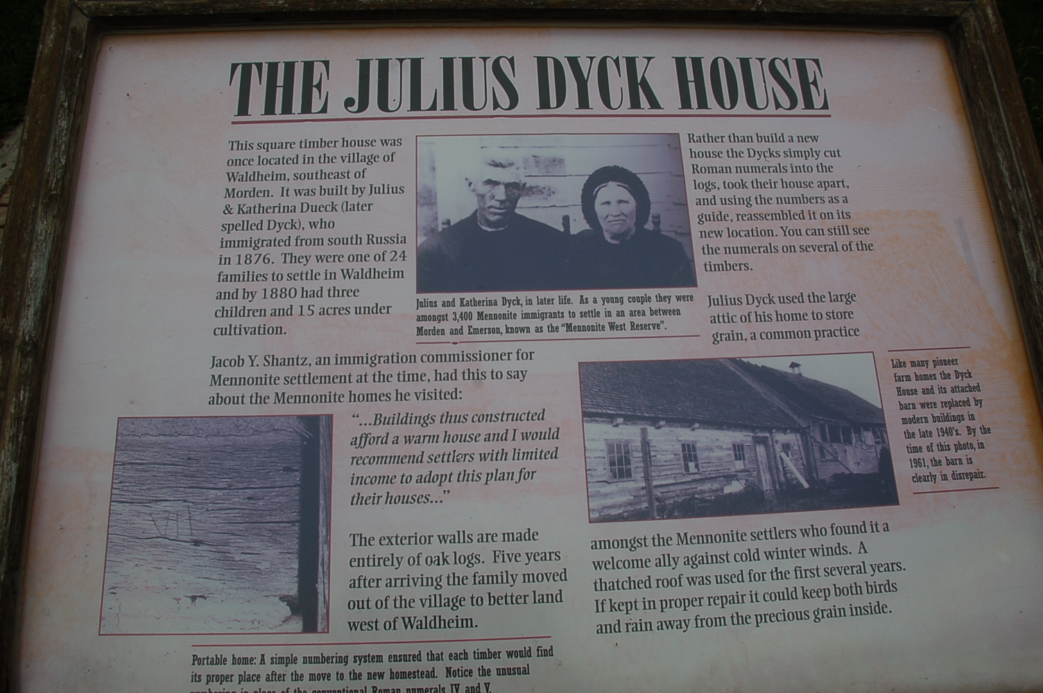
Of course found my way eventually and visited the Mennonite Heritage Village – another collection of old buildings brought to one point from all over Manitoba but laid out so well and full of genuine, sometimes the original, possessions of those families who had overcome the hardship of settling here.


Just a little aside, and I say this with no ill intention, but the sweet elderly volunteer who showed me around initially, explaining the collection, asked after hearing me speak, if I was “from out of the Province”. I said yes, indeed out of the Country, from England. ” Oh”, she said “Do you have old buildings there?” – honest!

It was a great site, I know I think they all are, and as every building had a known history it really brought that part of the past alive.

Then looked at an exhibition of photos of old abandoned homesteads on the prairie,


See, there are people as "anoraky" as me!!!

Well, that's the last of the planned detours done. Overnight in Winnipeg and then a straight run to Lyndsay, Reece and Darcy in Beaverton - satnav says 1238 miles - into and across Ontario.

Let's see what that brings...