Sunday, 26 May 2013

Sunday 26th May - Canada and the start of The Trans-Canada Highway!

Before I went to bed last night I put the tarp on the bike and lashed it down as the wind was up and the rain was coming. I therefore got up this morning expecting to have a fairly cool and damp ride up and over the border.

How wrong I was – well the weather forecast was actually – the sun was shining and it was already warm by the time I pulled out of Great Falls and headed north to the border crossing at Sweet Grass.
I went straight up the Interstate as it was only a dual carriage way in effect and the ordinary road ran next to it anyway. And there was nobody on it.
 
For almost  120 miles there was just me and an old guy – yes, even compared to me – on a Harley.  It was so quiet and companiable that we even stopped for a chat on the hard shoulder.

All the way the Rockies ran parallel to me way over to the east.
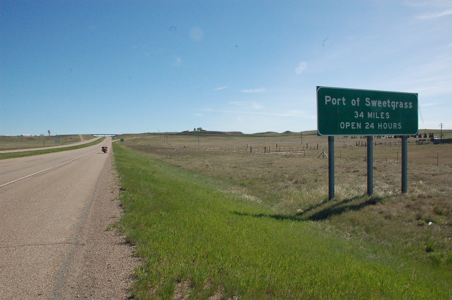
A bit more traffic turned up from somewhere at the Border Crossing but nothing to worry about so I crossed over to Canada without incident.

 
And Canada was shut!

I was ready for a coffee and wanted to sort things out now I was across border so I rode into Coutts, the town on the Canadian side, absolutely dead, no one around at all. No-one to ask if anywhere was likely to be open. Never mind, Medicine Hat – the first place I would hit ion the Trans-Canada Highway was only 143 miles away.

Didn’t have a very detailed map of Alberta – The Canadian Province I was in – so into the trusty Sat-Nav went Medicine Hat and I was steered out of town on  quiet -  waste of a word that, everywhere was quiet – country road.

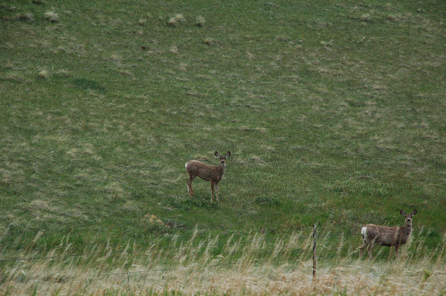
It ran East straight as far as I could see and that was a long way. By now it was a balmy 23°C, the wind was warm and light, I rode with my visor flipped up and all was well in the world. 16 miles of arrow straight road till I turned left. It was a wonderful ride, still a few hill on my right from the range I crossed before dropping down to the crossing but totally flat on my left.  I saw and heard  birds of all hues and yes, more deer – I know I said I wouldn’t photograph any more, but these were Canadian deer now.
They are much more robust, beefy – should be venisony I assume – than the ones I’d seen in America, less like Bambi and more like Rudolph if you get my drift. The American ones were Mule Deer which live west of the Rockies, these were White Tail Deer for those purists amongst you.
Life was good…… but then a bit of anxiety set in......

And it got worse

                              and worse.......

             The road ahead fizzled out and the “trusty”  Sat-Nav said turn left which I did and ground to a sideways, sliding halt – not fall number 4 but very close to it. It appears that setting to avoid “unpaved roads” – I’d learned that the hard way – didn’t mean she wouldn’t try gravel roads in Canada.  I just couldn’t ride through it, my road tyres just dug straight in and steering was akin to trying to pull a sow from her piglets – and yes I have tried that.
I looked around – and as I said I could see a long way – and there was nothing else for it – a lovely 16 mile ride on a road as straight as an arrow in the sun looking at the wild life – only going west this time!
Picked up a better road further north and eventually headed for Medicine Hat.
The land got flatter and the horizon dropped. I’ll stop trying to photograph it. Just imagine standing in a field, now expand the boundaries to infinity until you are looking down on the horizon – in every direction, 360°. Now place a blue dome over the whole lot and you are getting somewhere like.
Colourful farmsteads come up now and then, all surrounded by trees planted as a shield against the wind that can be merciless I understand - tell me about it!


In the few small towns, mostly just a few houses around a junction, there are grain elevators, mostly grey concrete jobs, but occasionally old colourful wooden ones like these. Get used to these  – I love them.

 I say grain elevators, they are probably Canola elevators, Rapeseed to you and me, the Canadians changed the name in the 70’s for a number of reasons primarily its “disturbing connotations” as they put it and the fact that in 1956 the rapeseed then grown in Canada was so toxic it was banned for human consumption – a bit of a handicap for cooking oil!

When I got there Medicine Hat was closed too. Well, a bit busier traffic wise but nothing obviously open.
After stopping to photograph this – I’m afraid you may also have to get used to me waxing whatever about the settlement of the Prairies – it’s my obsession on this return leg. This one is a tribute to the German/Russian Pioneers that settled here.
 
I asked a guy if there was anywhere to get a coffee –“Sure” he said “just go through the lights and through that underpass and there’s a Tim’s on the corner”.  Well there would be wouldn’t there -  probably not of any significance to anyone but the Canadian branch of the family but Tim Horton was a Canadian Ice Hockey player who reputedly started the chain because he didn’t like flying and therefore drove everywhere. He couldn’t find decent burger and coffee bars so started his own. I don’t know ...  but it is Canada’s number 1 Fast Food chain – out stripping McD’s and Stabucks. He died in 1974 bizarrely during a police chase on his way home from a match.
Had originally planned to stay overnight in Medicine Hat but it was only 2.30pm and it was such a gorgeous day I pushed on another 140 miles to Swift Current – hey the names get better, Moose Jaw next.
So I set of along The Tran-Canada Highway – another dream realised.
 
The Trans-Canada Highway runs between Victoria on Vancouver Island British Columbia and St. John's in Newfoundland. With a length of 4,860 miles it is the world's longest national highway. After driving east 800 miles from Seattle before joining it at Medicine Hat and then dropping off at my daughter’s in Beaverton, Ontario I am only riding 1912 odd miles of it – leaving scope for another ‘venture!!

It is a dual carriageway at this point - not at all like an Interstate and is still so quiet. Riding along at less than the speed limit - it's 110kph usually  - in the sun and warm breeze, lid still up and still lots of birds and deer around, it was really pleasant - actually more than that, wonderful - one of the best days I've had - and that is saying a lot!  I am one lucky chap I know.
By the time I arrived at Swift Current I’d clocked up 424 miles today so stopped at the first motel I found and crashed – no not literally I’m please to say.
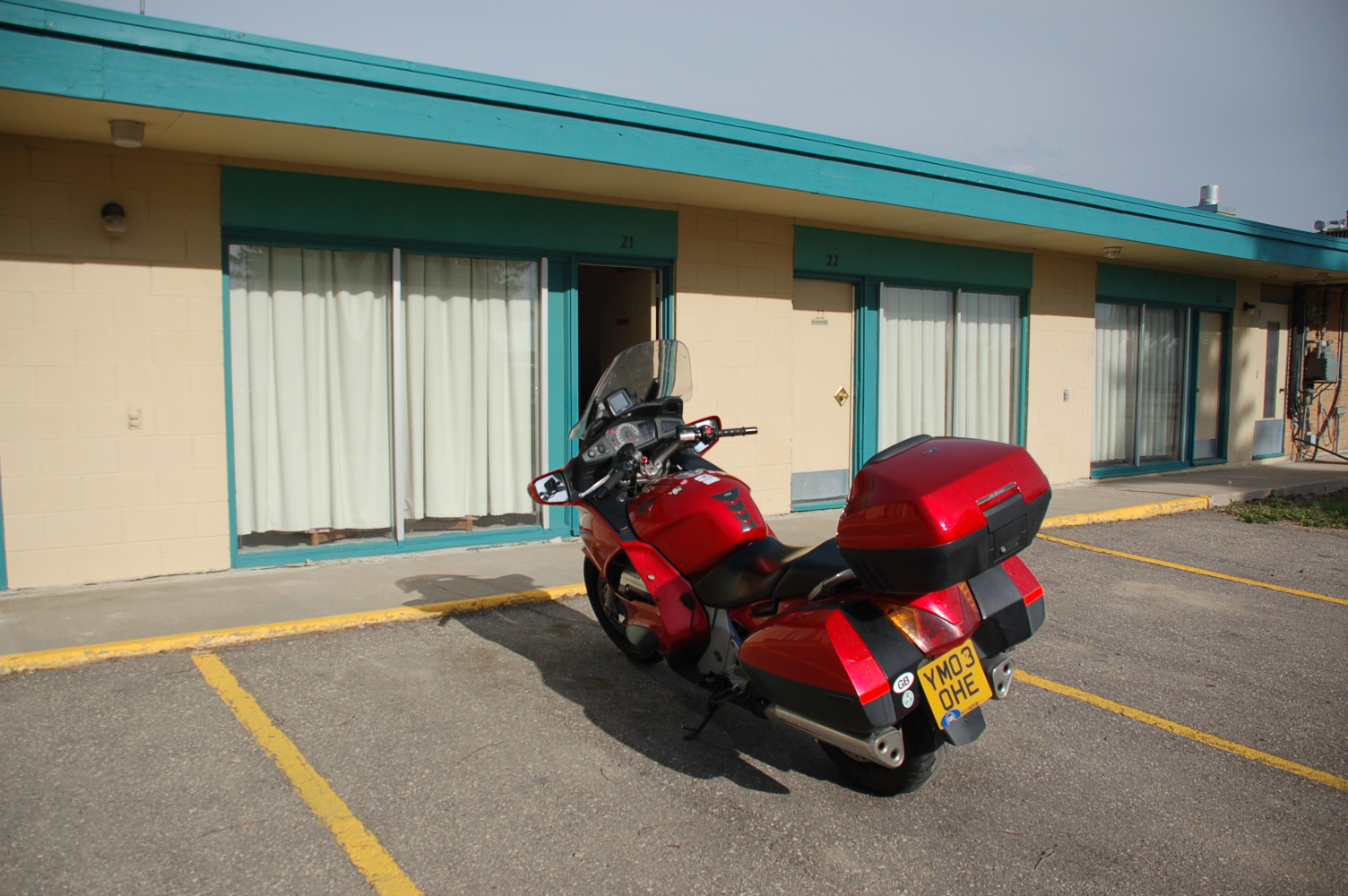
 
 
Haven’t therefore looked around the town – guessing it shut today anyway – but to give you a flavour, well you remember me saying that Santa Fe in New Mexico was characterised by the Lexus Car Lot – this place has a mile and a half stretch of lots selling John Deere tractors and equipment, Silos, etc.!

Weather forecast says thunder storms for tomorrow - here's hoping its wrong again.


Saturday, 25 May 2013

Saturday 25th May - Eastwards across Montana


Woke up to a damp and dismal morning. Wasn’t actually raining but looked like it would and it was still so cold. So put all clothes on again and off we went.
Initially I rode through wooded valley with fast flowing streams
 and then the valleys got broader and the rivers wider.


The morning warmed up so I shed clothes and looked forward to a more comfortable ride.
 
I knew exactly where I wanted to go…


And it is!

The land flattened then, the valleys got much wider and the rivers broadened


Then, just when I was thinking the cold passes where behind me
 
 
  the tail end of the Rockies, so that’s what that grey bit on the map meant!

Still, didn’t let it get me down. How could it when I was driving through an area where someone will take this much trouble with a post box....


Took a detour to the National Bison Range. I knew I couldn’t get in because they won’t let you ride around it on a bike for some reason but thought I may see them from the road. Quite disappointed to only see these two, and then in some kind of paddock...
Later on when I stopped for a snack I realised why the herd may be depleted – and looking at the portions they serve it’s a least one bison per burger.
 
Talking of portions, was in a restaurant the other day and a family came into the booth behind me, mum, dad and not so little Billy, or whatever. They all ordered a meal and then the waiter reminded them that it was a free child’s meal with every adult one so they were in fact entitled to two children’s meals. After some debate as to whether they should get a second child’s meal and take it home they decided, nay, Billy would have them both there and then, and he did!

These guys were near the Bison Range, some horns eh
And you have to admit they suit him more than they do this chap I met last night.....
Maybe they will look better when he mounts them on his truck - that was his plan!
 
This place looked an appropriate place to stop (believe me!!!)

 but Froggy had a better way of dealing with the problem – ahhhhhhhh!


The Rockies were always there but actually I didn’t have to climb too high to get through.


Although as I said I couldn’t ride along it on my bike I had been following the route of the first wagon route to cross the Rockies to the Pacific Coast - remember, this chappie Capt. John Mullan
and therefore the road I was on swept around the contours of the land much as Route 66 had. Big difference though was this a predominantly green landscape be it grassland or forests and there were rivers everywhere.


Those rivers were beautiful and where they were deeper and slower they were apparently home to the endangered Bull Trout. There was fishing everywhere so I don’t know what they do catch.
Where the river was fast and narrow it was great for other types of sport – makes my bike ride look a doddle.


When I first drove past this sign I thought it was The Herpes Capital of the World…

      See, I told you it was cold.

There was still plenty of wild life and enough dead deer on the road to convince me that riding at night still not a good idea. 


 Oh forgot to say, I saw a bull moose yesterday in Idaho. It was standing in that iconic pose in swamp up to its knees – assume moose have knees – and just staring at me. I couldn’t stop as it was persistently raining and too dangerous. Looking it up on Google it says the population around here is “exploding” but as I said this one just stood there.
 
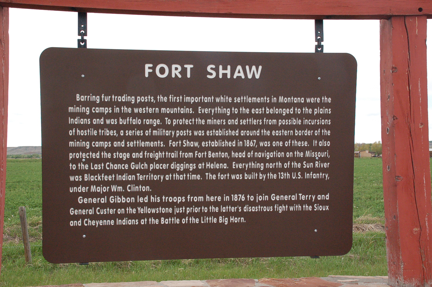
As I approached Great Falls I passed the site of an old - in American terms - Fort. Nothing there now, but it was exciting to think that people who passed through here 140 years ago would go on to rub shoulders with Custer and who knows, may have seen Sitting Bull.
 
Well, if things go to plan I cross over border to Canada tomorrow. Tonight will involve making sure all that paper work I have carried around in my little black bag for 6 weeks is in order....


Friday 24th May - The final leg. Eastbound from Washington, through Idaho to Montana


Tonight I make no apologies for the self-indulgent nature of the blog. I had a mission and it was completed.
I left Seattle in a few spots of rain but the sky was clear. A bridge had collapsed on the I5 last night but although we had used that road going to Orcas we were nowhere near it when it happened. So, I had a good run through the north of Seattle and then turned east  on the I90 heading for Haugan, Montana,  My target was the $10,000 bar where we had visited some years ago with Fred and Becky and where following that visit Fred had put up a silver dollar in my name - number 54,757. Today the bar is called the $50,000 bar so it is still a bit behind!

I had been warned that travelling through the Snoqualmie Pass - 3022ft – of the Cascade Mountains would inevitably involve riding through rain – snow was predicted above 4000ft – but in fact it was dry all through. 


 But boy was it cold – my top box and panniers were almost empty because I was wearing all the clothes I possessed – looked like the Michelin man but was still cold – tumble-weed willie was a distant and fond memory!
All the prayers I had uttered when riding through the blistering heat of the Arizona desert had belatedly been answered and a snow fringed 6°C was the response.


 The rain came later though
 
 and I had a “challenging” ride on through Idaho and into Montana. I had wanted to take some side roads which had some historical significance but they were dirt roads of clay and gravel and in the rain the resultant slip meant that if I had dropped the bike I probably wouldn’t be able to get enough purchase to lift it so I bottled it and took paved roads - I know - wimp!
A lot of history in those roads though …

The Mullan Road was the first wagon road to cross the Rocky Mountains to the Inland of the Pacific Northwest. It was built by US Army Lieut. John Mullan between the spring of 1859 and summer 1860...

that's the anorak bit done.

Bits were dropping off as I came down from the mountains and never have I been so pleased to see a burger bar as when, approaching the Columbia River

                            the Blustery’s Burger Drive-In at Vantage appeared.


A really great place with happy staff and wonderful signage….


 Crossed over the Columbia and when I stopped for a backwards looking photo


 I saw these 15 horses  
 
 They are made of rusted steel and weigh about 1,200 pounds each. They were commissioned in 1989 to honour the days when real wild horses roamed the arid steppes. The area near Vantage was the site of the last grand roundup of wild horses in 1906. The artist is David Govedare.
The road then led through the “big sky” area of east Washington where there was nothing but fields as far as they eye could see and then up into the mountains, streams and lakes of Idaho.


This was an area where numerous attempts had been made to drive a route through to the west and just when I thought I had reached the plains of Montana more mountain passes and snow and ran, and fog hit me


Thought we spoke roughly the same language but perhaps a different definition of "Prime"...


Then Montana started but the rain didn’t stop. Still, fortunately a very nice receptionist at the bar’s motel found a great place for the bike


and then I checked in to coffee and a hot shower.
After both the above I went over to the bar and the self-indulgent bit is coming ...

The bar dates back to 1951 when Gerry and Marie Lincoln hammered a silver dollar into the  bar of their small saloon. The idea caught on and by 1953 over 2000 people had placed their coins in the bar top. That bar top is still in use and contains 2115 dollars. 


 All the others, currently  62,319 mounted are embedded in boards displayed around the bar's walls.


A bit of smooth talking with Phyllis the barmaid – I can do it when I have to – who” just loved” my accent


 I found the dollar Fred had put there for me - number 54,757, she looked it up on a computer and then gave me a grid reference akin to locating the Graf Spee in the River Plate and a pair of binoculars – honestly – and there it was.
I then gave her a Silver Dollar Becky had given me and “Fred Staatz, Seattle” will soon be up there with the best, number 64125!

The story surrounding this slug is apparently true ...

 
Here’s the indulgent bit ……  I then worked my way through the local beers, Moose Drool, Copper John Scotch Style Ale, Pigs’ Ass Porte and Big Sky IPA washed down with Cinnamon Whiskey (and those that thinks this is a bit soft should try it|) and drank to absent friends -  Evan, Fred, Jerry, Brian – He seems to take the best!  I am very priviledged to have known them all.